New Zealand lies in the collision zone between the Pacific and Indo-Australian tectonic plates, within the Pacific Basin “Ring of Fire,” where the majority of the world's earthquakes and volcanoes occur. On average, the country experiences about 15,000 earthquakes per year, but only around 250 of those events are large enough to be felt.
Significant earthquakes in the past decade have necessitated a reassessment of seismic risk in the country; however, the most powerful earthquake New Zealand has experienced in at least the last two centuries—the Wairarapa seismic event—struck 165 years ago on January 23, 1855.
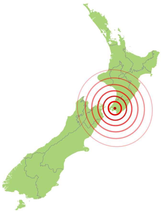
The quake, estimated to have been about Mw 8.2, occurred at a centroid depth of 17.5 km following movement along ~140 km of the Wairarapa Fault (Figure 1). The mainshock lasted for at least 50 seconds and aftershocks continued for months. Shaking was felt across the entire country and the landscape changed as land moved 18 meters horizontally along the fault, the southern end of the Remutaka Range in the lower North Island rose by more than 6 meters, and portions of South Island across the Cook Strait subsided.
Wellington, at the southern tip of North Island, was declared a city in 1840, one year after the first Europeans arrived to purchase land; the city was declared New Zealand’s capital in 1865. The city experienced a series of earthquakes in 1848, including an M7.0 quake that caused major damage to brick and stone structures, including many homes, churches, the jail, and the Colonial Hospital. As a result, the city was largely rebuilt with timber.
During the 1855 earthquake, timber-framed single-story homes once again withstood the shaking well, experiencing damage principally to their brick or masonry chimneys, while extensive damage was caused to masonry structures. Between five and nine lives were lost in 1855; this low number was largely attributed to the prevalence of timber construction.
Timber was the favored material for reconstruction following the 1855 event. After Wellington became the nation’s capital in 1865, for example, the government building that opened in 1876 was the second-largest timber structure in the world until 1998. Before long, however, earthquake risk faded from memory. Encouraged by the city council’s fire safety regulations, unreinforced masonry (URM) returned to favor.
The uplift in 1855 added beach and rock platforms along the coast, so jetties and quays in the harbor at Wellington were suddenly located inland. The new strip of coastal real estate provided a safe road and rail route into the Wellington, which was not slow to expand into it. Much of today’s central business district occupies land that was underwater until 1855.
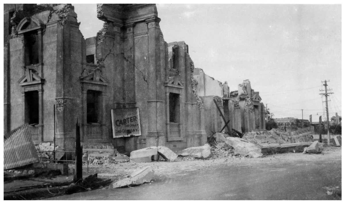
By 1900 the earthquake hazard had been largely discounted in New Zealand, but the M7.4 Hawkes Bay Earthquake of 1931 was a major wake-up call. This, the most damaging earthquake to strike the country in recorded history, struck the east coast of North Island and devastated the cities of Napier and Hastings. Earthquake risk to communities in New Zealand has since been partially mitigated by the development and rigorous enforcement of stringent national building codes. The use of URM in New Zealand declined after the Hawkes Bay Earthquake, for example, and the building code has explicitly prohibited its use in new structures since 1965.
Wellington exhibits high seismic risk because its proximity to several northeast-southwest trending fault traces exposes it to the potential for strong ground shaking. Furthermore, much of its central business district and waterfront is underlain by soft sediments, which amplify ground shaking and are particularly susceptible to liquefaction-induced subsidence. In addition, most of the major routes into the central business district retain a high proportion of older buildings (such as URM structures that pre-date the 1965 ban), which are more vulnerable to ground shaking than modern structures.
The 2010-2011 Canterbury Earthquake Sequence caused more than NZD 30 billion in insured losses. This swarm of events, along with the more recent 2016 Mw7.8 Kaikoura earthquake, changed the perception of the region’s seismicity and revealed new data on faults and vulnerabilities. The AIR Earthquake Model for New Zealand provides the most up-to-date and comprehensive view of earthquake risk and enables stakeholders to prepare for and mitigate potential future impacts.
To learn more, read “Earthquake Risk in New Zealand: A Major Model Update”