


The Growing Value of U.S. Coastal Property at Risk
Apr 23, 2015
Editor's Note: AIR's first The Coastline at Risk report, published 10 years ago, drew a direct link between the increase in hurricane losses and the growing number and value of coastal properties. The steady increase in the number and value of exposed properties along the U.S. Gulf and East coasts continues unabated, according to AIR's subsequent reports.
The growing number and value of coastal properties is the largest factor impacting hurricane risk today. The risk is compounded by rising sea levels and the concomitant increase in damage caused by hurricane storm surge. AIR's seminal 2005 The Coastline at Risk report, and its 2008 and 2013 updates, represent major milestones in our continuing work on quantifying coastal properties at risk.
People love living by the sea for the many economic and recreational opportunities coastal living offers. Around the world, coastal populations are growing faster than those in noncoastal areas, and many of the world's coastlines are becoming increasingly; urban 14 of the world's 17 largest cities are located along coasts, 11 of them in Asia.1 By the end of the 20th century about 3 billion people, more than half of the planet's population, were living within 120 miles (200 km) of a coast, and that figure may double by 2025.2
At the same time, sea levels are rising as a result of climate change. The oceans rose about 7.5 inches (190 mm) on average between 1901 and 2010 worldwide3, and the current global mean rate is very likely slightly more than 1/16 inch (1.7 mm) each year.4 According to the National Oceanic and Atmospheric Administration (NOAA), "this is a significantly larger rate than the sea-level rise averaged over the last several thousand years," and the rate may be increasing.5
Low-lying countries are the most vulnerable. Some people living in New Guinea and Tuvalu—which may be entirely submerged within a few decades—have already relocated, and the Maldives may be uninhabitable by 2100. But it is not just a few remote locations that are in harm's way; major coastal communities around the globe are at risk.
 By: Dr. Tim Doggett
AVP, Principal Scientist
Edited by Jonathan Kinghorn
The article:
- The population in U.S. coastal counties (which contain 14 of the country's 20 largest metropolitan areas) grew by 84% between 1960 and 2008.
- Using Touchstone's Geospatial Analytics Module and AIR's maximum modeled storm surge extent, AIR estimates that the total value of insurable property in ZIP Codes potentially impacted by storm surge is USD 17 trillion.
- With additional exposure and higher sea levels, storm surge can inflict growing levels of damage and loss, even if tropical cyclones do not become more frequent or more severe.
The U.S. Coastal Population
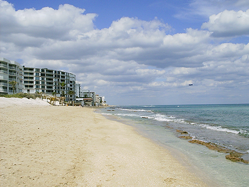
Like people all over the world, Americans have been flocking to coastal areas. According to the U.S. Census Bureau, the population in coastal counties (which contain 14 of the country's 20 largest metropolitan areas) grew by 84% between 1960 and 2008, compared to 64% in noncoastal counties.6 The number of people living in coastal shoreline counties in 2010 (including the Great Lakes region, which is not impacted by sea level rise) represented 39% of the population, and between 2010 and 2020, it is expected to grow by an additional 8%.7
U.S. Census Bureau data from 2012 indicates that the nine states with the highest population density are all located along the East Coast and the five states experiencing the greatest rise in population recently—California, Texas, Florida, Georgia, and Virginia—are all coastal. The sixth fastest-growing region in the U.S. in 2014 was south Florida, where roughly three quarters of the population already live along the coast. Growth here has accelerated in recent years, with Miami-Dade's population expanding by 2.1% in 2011 alone.8
Growing Coastal Exposure
The growth of coastal property exposure follows population growth. People don't just live near the sea, they also shop, work, and seek entertainment there. Between 2000 and 2010, the total number of housing units in coastal shoreline counties increased by 8%, and the number of seasonal housing units increased by 18%.9
| State | State Total | Coastal Counties | Percent Coastal | |||
|---|---|---|---|---|---|---|
|
|
2004 | 2012 | 2004 | 2012 | 2004 | 2012 |
| Alabama | 631.3 | 917.8 | 75.9 | 118.2 | 12% | 13% |
| Connecticut | 641.3 | 879.1 | 404.9 | 567.8 | 63% | 65% |
| Delaware | 140.1 | 208.9 | 46.4 | 81.9 | 33% | 39% |
| Florida | 2,443.5 | 3,640.1 | 1,937.4 | 2,862.3 | 79% | 79% |
| Georgia | 1,235.7 | 1,932.2 | 73.0 | 106.7 | 6% | 6% |
| Louisiana | 551.7 | 823.0 | 209.3 | 293.5 | 38% | 36% |
| Maine | 202.4 | 285.5 | 117.2 | 164.6 | 58% | 58% |
| Maryland | 853.6 | 1,293.4 | 12.1 | 17.3 | 1% | 1% |
| Massachusetts | 1,223.0 | 1,561.4 | 662.4 | 849.6 | 54% | 54% |
| Mississippi | 331.4 | 468.5 | 44.7 | 60.6 | 13% | 13% |
| New Hampshire | 196.0 | 278.7 | 45.6 | 64.0 | 23% | 23% |
| New Jersey | 1,504.8 | 2,129.9 | 505.8 | 713.9 | 34% | 34% |
| New York | 3,123.6 | 4,724.2 | 1,901.6 | 2,923.1 | 61% | 62% |
| North Carolina | 1,189.3 | 1,795.1 | 105.3 | 163.5 | 9% | 9% |
| Rhode Island | 156.6 | 207.5 | 43.8 | 58.3 | 28% | 28% |
| South Carolina | 581.2 | 843.6 | 148.8 | 239.3 | 26% | 28% |
| Texas | 2,895.3 | 4,580.7 | 740.0 | 1,175.3 | 26% | 26% |
| Virginia | 1,140.2 | 1,761.7 | 129.7 | 182.3 | 11% | 10% |
| All States Above | 19,041.1 | 28,331.4 | 7,203.7 | 10,642.2 | 38% | 38% |
| Total U.S. | 43,665.6 | 64,624.3 | 7,203.7 | 10,642.2 | 16% | 16% |
Table 1 shows AIR estimates for the insured value of properties in coastal states and, separately, in the coastal counties within those states, in 2004 and 2012. The percentage of insured value in coastal counties has not varied much during this decade, but the total values have grown significantly.
In the state most prone to hurricanes—Florida—close to 80% of the total insured value is located in coastal counties. Texas and the densely populated Mid-Atlantic and Northeast states are also at considerable risk. Overall, 38% of the total exposure in Gulf and East Coast states is located in coastal counties, accounting for 16% of the total value of properties in the U.S.
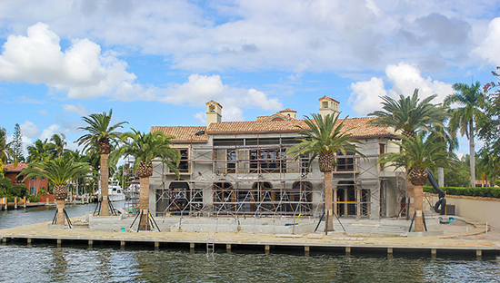
Historically, the insured value of properties in coastal states has grown at an estimated compound annual rate of about 7%. That translates to a doubling every decade of insured values and potentially insured losses. Although housing starts took a significant downturn during the post-2008 recession they have recovered.
Because hurricane storm surge—which is an abnormal and often substantial increase in sea level—can penetrate miles inland from the coast, considerable value is at risk, as it seems the appetite for ocean views is unabated.
| Line-of-Business | Total Insurable Value |
|---|---|
| Residential | 8,578 |
| Commercial | 7,750 |
| Manufactured Home | 213 |
| Auto | 512 |
| TOTAL | 17,056 |
Using Touchstone's Geospatial Analytics Module and AIR's maximum modeled storm surge extent, AIR estimates that the total value of insurable property in ZIP Codes potentially impacted by storm surge is USD 17 trillion. Table 2 breaks down this total by line of business. California and the Pacific Northwest states are excluded from this total because the AIR U.S. Hurricane Model does not model storm surge on the Pacific Coast.
Rising Seas and Storm Surge
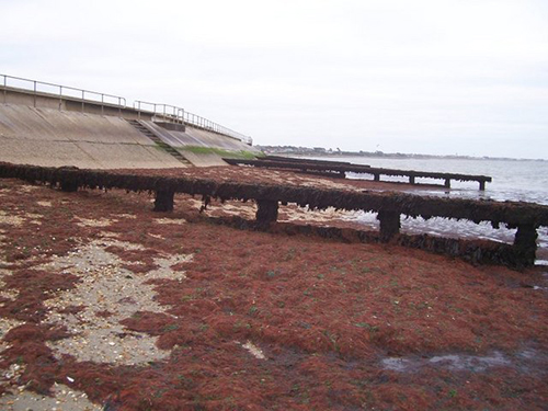
Much of the coastline along the East and Gulf coasts of the United States is less than 10 feet above mean sea level, leaving these low-lying areas vulnerable to the effects of sea level rise over the long term, and flooding generated by hurricane storm surges in the short term. In some areas natural geological movements or the extraction of underground stores of water, oil, and gas are causing the ground to sink, exacerbating the effect of sea level rise.10 Projections of the amount of expected sea level rise over the next century are subject to a wide range of uncertainty. However, the highest projected 100-year sea level rise on the Gulf Coast could be as much as 4 feet (122 cm) in southern Louisiana where subsidence is most prevalent, and the highest projected on the East Coast, is on the order of 2 feet (60 cm) in Virginia.11 Currently 82% of the Virginia coastline—some 1,597 miles (2,570 km)—is considered to be at high or very high risk.12 As sea levels continue to rise, the combined effects of sea level rise and hurricane storm surge will produce damaging floods unlike any in recorded history.
There are 4.2 million U.S. residents living at an elevation of 4 feet (1.2 m) or less, and 2.4 million of them are in south Florida.13 With just 3 feet of sea-level rise—and in the absence of mitigation measures—more than a third of southern Florida would vanish; with 6 feet, more than half would disappear, along with Miami's waterfront.14 One of the U.S. cities most vulnerable to storm surge and sea-level rise is Tampa due to the shallow bathymetry on the west coast of Florida, which places Tampa at particular risk from storm surge.
Storm surge is one of the principal causes of coastal inundation, and it can create severe devastation many miles inland in low-lying coastal regions. As sea levels rise, average high tides will become higher. The height achieved by any given storm surge above those high tide levels and the extent of inland inundation caused by it will increase.
The rising level of the oceans, the growing coastal population, the additional development associated with it, and the possible increasing severity of storms mean that people and property are increasingly at risk. Coastal communities have three options when it comes to dealing with this enhanced risk of flooding. They can do one of three things:
- Defend the shoreline with man-made or natural barriers
- Adapt by raising structures and infrastructure above projected flood levels
- Retreat
Defenses like seawalls and groins (low barrier walls built into the sea from a beach to check erosion and drifting) are expensive to build and maintain, and they can have detrimental impacts such as causing beaches to erode or disrupting natural shoreline processes. Major centers of population with political clout are best placed to secure the major funding needed for building such defenses. New York City for example, is planning a mix of defense and adaptation measures estimated to cost USD 20 billion.
Less affluent communities are unlikely to be able to afford defenses without a great deal of financial assistance, but adaptation and retreat have their costs, too. It is expensive to raise a property, or for the government to acquire it so that the homeowner can move elsewhere. Most, if not all, coastal communities will probably adopt a pragmatic blend of the three options outlined above that best suits their circumstances.
While the steady increase in the number and value of exposed properties along the U.S. Gulf and East coasts continues unabated, sea levels are rising inexorably and are expected to do so for centuries. With additional exposure and higher sea levels, storm surge will inflict growing levels of damage and loss, even if hurricanes themselves become neither more frequent nor more severe. Coastal development remains the largest factor increasing the hurricane risk of property insurers today.
1 Liz Creel, Ripple Effects: Population and Coastal Regions, Population Reference Bureau, 2003
2 Ibid
3 U.S. Global Change Research Program, The 2014 National Climate Assessment, May 2014
4 Intergovernmental Panel on Climate Change, Climate Change 2013, The Physical Science Basis, The Physical Science Basis, September 2013
5 NOAA, Is sea level rising?, revised April 2014
6 U.S. Census Bureau, Coastline Population Trends in the United States: 1960 to 2008, May 2010
7 NOAA, National Coastal Population Report, March 2013
8 World Population Review, Miami Population 2014, October 2014
9 NOAA, National Coastal Population Report, March 2013
10 Robert A. Morton , An Overview of Coastal Land Loss: With Emphasis on the Southeastern United States, USGS Open File Report 03-337
11 NOAA, State of the Coast, revised July 2011
12 Ibid
13 Robin McKie,Miami, the great world city, is drowning while the powers that be look away, The Guardian, July 2014
14 Ibid
