


Capturing the Complexities of Caribbean Industry Exposure
May 26, 2020
AIR’s Industry Exposure Databases (IEDs) provide the foundation for all modeled industry loss estimates. They comprise detailed collections of exposure data containing information on insurable properties and their respective replacement values, along with information about the occupancy and physical characteristics of structures, such as construction types and height classifications. Information pertaining to standard industry policy conditions, such as limits, deductibles, and take-up rates by peril, is also incorporated into each country's IED.
As catastrophic events occur infrequently, there are limited data available about the impact such events may have on the built environment, especially one as diverse as the Caribbean’s. For example, a recently constructed mixed-use building with commerce on the first two floors and condos on the floors above would perform very differently than a decades-old wood-frame single-family home would under the same hurricane-force winds. Because the substantially updated AIR tropical cyclone and earthquake models for the Caribbean, anticipated for release this summer, cover 29 countries—each of which has its own building stock and policy terms—building comprehensive IEDs that realistically capture those unique characteristics required a multifaceted approach.
The Caribbean IEDs: Building the Foundation for Risk Assessments
Each country in the Caribbean has its own building practices and codes in addition to unique policy conditions. A comprehensive understanding of exposure in the region is therefore needed to accurately assess any catastrophic risk—e.g., hurricane, earthquake, etc.—in the Caribbean. Through conducting post-event damage studies, leveraging satellite data, and performing extensive research, AIR developed a high-resolution IED for each of the 29 modeled countries in the Caribbean that captures the unique characteristics of structures and policy terms.
Post-Event Damage Surveys Confirm and Enhance Knowledge of Industry Exposure
AIR often conducts damage surveys after catastrophic events; the primary objective is to gain as much knowledge as possible from each event and use our findings to continuously improve our catastrophe models. We conduct these surveys not only to understand the performance of the built environment but also to test the modeling assumptions we make. In recent years, the Caribbean has suffered multiple catastrophic events for which damage surveys were conducted.
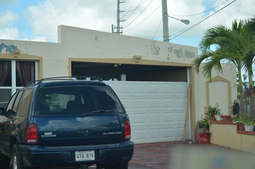
After Hurricane Maria struck the Caribbean in 2017, for example, AIR’s damage survey of affected areas in Puerto Rico revealed that “bunker style” homes—reinforced concrete single-family buildings that are a form of construction with reinforced columns or walls, and a reinforced concrete roof framed monolithically into the walls (Figure 1, left panel)—indicated that while damage to nonstructural components (e.g., windows, doors, and rooftop solar water heaters) of bunker style buildings can occur at different wind speeds, these buildings typically maintain their structural integrity, even during major hurricanes.
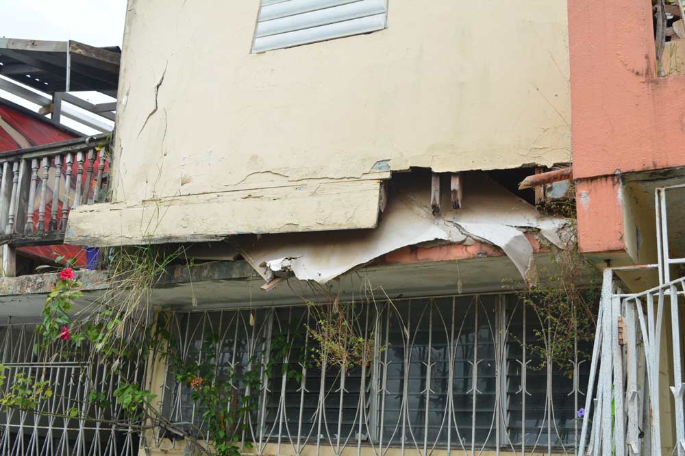
Other structures did not perform as well and sustained more significant damage, including structures of mixed material construction. For mixed material buildings, the first story is made like a bunker style home and the second story consists of a more vulnerable wood frame or unreinforced masonry construction with a light metal roof, typically built as an unofficial addition to the building to expand the space for higher occupancy. Damage to the highly vulnerable second story can cause further loss to the first story in these mixed constructions, mainly due to water leaking from the second to the first story. After Maria, AIR observed that roofs of these buildings had been torn off and that their walls had failed, often due to a lack of a continuous load path or inadequate connection between construction types within the structure (Figure 1, right panel). Findings such as these are reflected in the AIR Caribbean IEDs to provide an accurate view of the building stock and its performance under hurricane conditions.
AIR also conducted damage surveys after Hurricane Dorian struck the Bahamas in 2019, wreaking damage and destruction mainly on Grand Bahama and the Abaco islands, with the most populous island of New Providence escaping a direct hit. The Bahamas was the first Commonwealth Caribbean country to have a mandatory building code incorporating modern standards. The Bahamas Building Code (BBC) was implemented in the early 1970s and its use is mandatory in building design and construction. While the BBC is one of the best building codes in the Caribbean, it still lacks thorough specifications and construction detailing requirements for some critical regions and elements of the roof, such as ridges and overhangs, which typically contribute considerably to the vulnerability of not only the roof but also the building as a whole. In addition to the effectiveness of the standards set out in a building code, their enforcement plays a significant role in vulnerability. In the Bahamas, Ministry of Works’ inspectors visit buildings at various stages of their construction, but because of a lack of resources, training that lacks rigor in some cases, and geography, these inspections are not always very stringent and can result in deficiencies.
Findings from our damage surveys of residential, commercial, and industrial exposure provided insights into the importance of building codes as well as critical information on construction splits and policy terms, all of which is reflected in the AIR IEDs for the Caribbean.
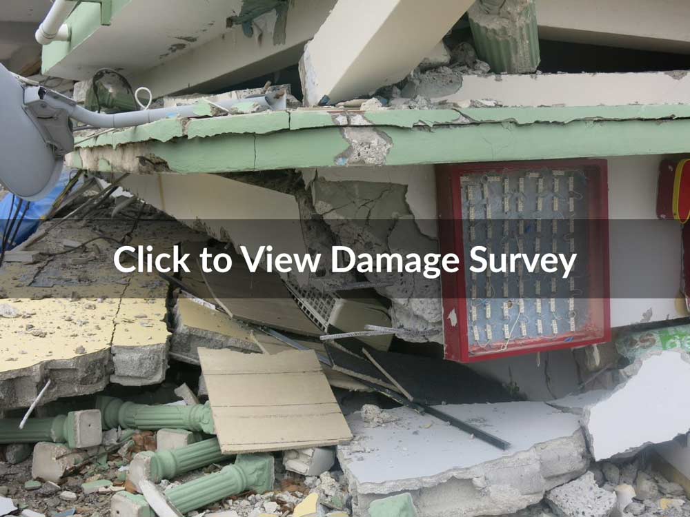
Hurricanes are not the only peril to cause devastation in the Caribbean, however. Earlier this year, an M6.4 earthquake struck Puerto Rico—the most powerful earthquake to occur there since 1918. AIR’s damage survey revealed four types of damage to be prevalent in the neighborhoods visited (Figure 2):
- Short-column damage, which occurs when short columns—relatively short, stiff, brittle columns—attract large seismic forces, leading to severe damage and failure if they are not designed and/or reinforced appropriately
- Soft-story damage, which occurs when soft stories—levels in buildings that have noticeable stiffness/strength reduction in comparison to floors above or below—lead to collapse during an earthquake
- In-plane damage, which occurs when unreinforced, load-bearing masonry walls suffer shear failure (diagonal cracking) that generally starts from corners of openings
- Inadequate reinforcement damage, which occurs when a building lacks ductility—the ability to deform under stress—that could have been provided by detailed reinforcement in locations where structural failure potential is high.
 Chris Beston, CPCU, CEEM
Director
Edited by Rachel Wisch, CEEM
The patterns of structural damage seen in reinforced concrete and masonry buildings are well-documented from past earthquakes and confirmed coverage and construction splits in the Caribbean IEDs for AIR’s updated tropical cyclone and earthquake models.
Leveraging Satellite Data to Realistically Capture Complex Caribbean Exposure
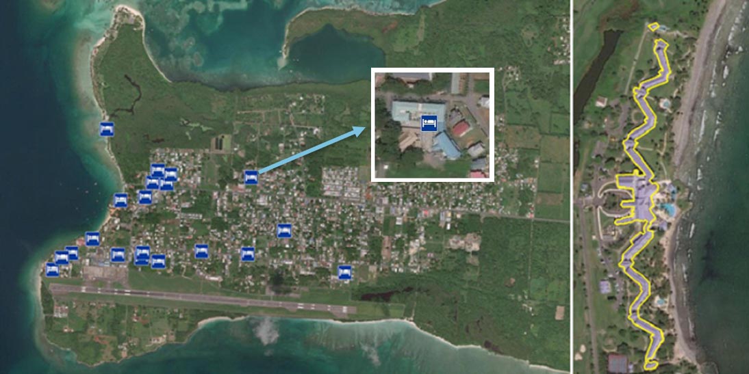
In addition to damage surveys, AIR leveraged satellite data to develop a highly detailed understanding of construction types, footprints, and spatial distributions of structures for the Caribbean IEDs. These data were especially critical to ensure the accurate inclusion of hotels and resorts, which serve as a primary source of revenue for the region’s economy. Hotels and resorts are particularly challenging to capture realistically, as they comprise multiple structures of single- and mixed-use and have sprawling footprints. One resort, for example, can have separate buildings stretching along hundreds of feet of beachfront and extending inland, creating an intricate footprint with varying risk factors (Figure 3). To accurately capture their complexity in the IEDs, AIR identified every hotel and resort in the Caribbean individually using satellite data to ensure the most realistic view possible.
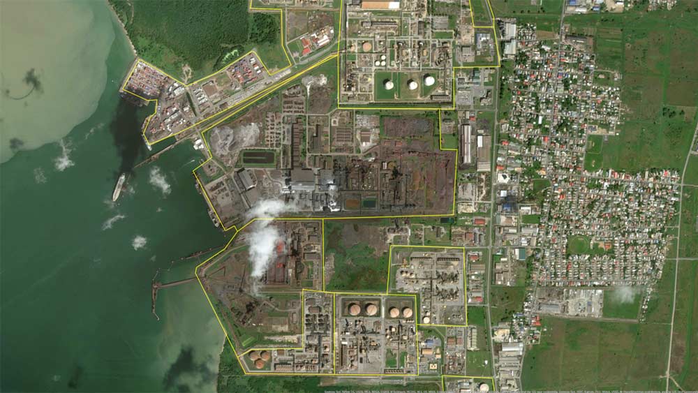
Like hotels and resorts, large industrial facilities—including pharmaceutical, power generation, fabrication and assembly, chemical, and cement facilities—represent a major revenue source for the region and are often complex structures. One facility, for example, can have a very large footprint comprising multiple structures and varying occupancies, such as a pharmaceutical facility that has an office building, a research and development lab, and a manufacturing plant. These facilities can also be near one another, which can directly affect their vulnerability; for example, a fire in a fertilizer plant next to a methanol plant increases the risk for the methanol plant even though it is a separate facility (Figure 4). AIR also used satellite data to individually identify large industrial facilities and ensure realistic footprints. Combined with capacity data (such as megawatts produced by a power plant or how much of a certain product a facility can produce) and information for other known features (such as building size), AIR also developed replacement values for each individual facility, which have been incorporated into the Caribbean IEDs.
In addition, large villas are popular in the Caribbean and differ from the average single-family home; they are larger, constructed to the highest quality, and typically include higher-end finishes. These factors increase the rebuild costs of large villas and require consideration for how they will perform, as their higher-quality construction can mitigate some damage during a catastrophe. Large villas also have different coverage splits that incorporate a larger time element amount than a single-family home. Here, too, satellite imagery enabled AIR to locate large villas within the model domain, ensuring a comprehensive view of exposure across the Caribbean.
Capturing the Current Caribbean Built Environment
Building codes and policies in the Caribbean region have evolved in just the past decade, and certain islands have experienced rapid development spurred by the tourism industry. Findings from research into the built environment after recent events and current satellite imagery, in addition to detailed study of building codes, their requirements, and enforcement levels, as well as local data sets, enabled AIR to capture the current built environment in the Caribbean. AIR’s IEDs for the Caribbean provide the most current exposure data available to ensure risk assessments are using up-to-date building and policy information.
Higher Resolution IEDs for More Accurate Risk Estimates
The information collected and analyzed from both damage surveys and satellite data was combined with data from site visits, claims, government, media, local sources, academia, and tax and census records to develop IEDs for the Caribbean that consist of the latest available information on risk counts, building characteristics, and replacement costs at a 90-meter resolution for all 29 countries within the model domain.
Companies can take advantage of this detailed exposure data in their risk assessments in Touchstone Re™—AIR’s reinsurance catastrophe modeling platform—for more accurate industry loss estimates. The Caribbean IEDs can also be used to validate building characteristics to more accurately assess a portfolio’s risk. By leveraging AIR’s IEDs for the Caribbean, companies can make more accurate modeled risk estimates.
