
With the 2017/2018 U.S. and Canadian crop seasons at an end, crop risk managers are looking ahead to next season. What do the likely El Niño conditions anticipated in early 2019 mean for crop yield and how should (re)insurers react?
What Is ENSO?
According to the National Oceanic and Atmospheric Administration (NOAA), “El Niño and La Niña are the warm and cool phases (respectively) of a recurring climate pattern across the tropical Pacific called the El Niño-Southern Oscillation” (ENSO). A period with elevated sea surface temperatures (SSTs) is known as El Niño, and the corresponding period of cool SSTs is known as La Niña. While oceanic temperature changes associated with El Niño events might be limited to the Pacific Ocean, the larger impacts of ENSO are globally felt through atmospheric teleconnections (i.e., large-scale pressure and wind patterns).
The Impact of ENSO on U.S. Corn and Soybean Yields
Increases and decreases in temperature and precipitation associated with ENSO teleconnections can impact crop development and, therefore, crop yields. Such weather can also impact days suitable for fieldwork, planting dates, irrigation decisions, and sunshine hours, all of which can impact crop yield. Research suggests that in the summer leading up to a strong El Niño event, ENSO teleconnections are associated with lower daytime maximum temperatures for important Midwest corn and soybean growing regions. The opposite occurs in those regions leading into a La Niña, with warmer daytime maximum temperatures and, importantly, generally lower yields. Other research suggests ENSO only modestly affects U.S. corn and soybean yields; around 15% of the long-term variance can be attributed to ENSO.
ENSO Prediction and Crop Risk Management
There are many reasons you might want to know early in the year what the yield of crops will be at the end of the growing season. You might be an insurance company pricing reinsurance, a trader buying or selling commodity options, a water company allocating irrigation resources, or a farmer trying to hedge your yield. Knowing what ENSO is going to do might give some measure of information to make better forward-looking decisions.
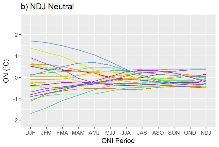
Upon reviewing Oceanic Niño Index (ONI) data—a primary index used by NOAA to monitor ENSO that tracks the running three-month average SSTs in the equatorial Pacific between 120°W and 170°W—one can see that years may start with wildly different conditions and end in similar outcomes (Figure 1). Figure 1a, for example, indicates a wide range of possible ONI start points that end in an El Niño (ONI of +0.5°C) near the growing season (around September).
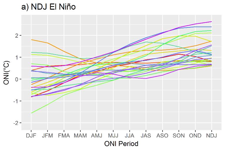
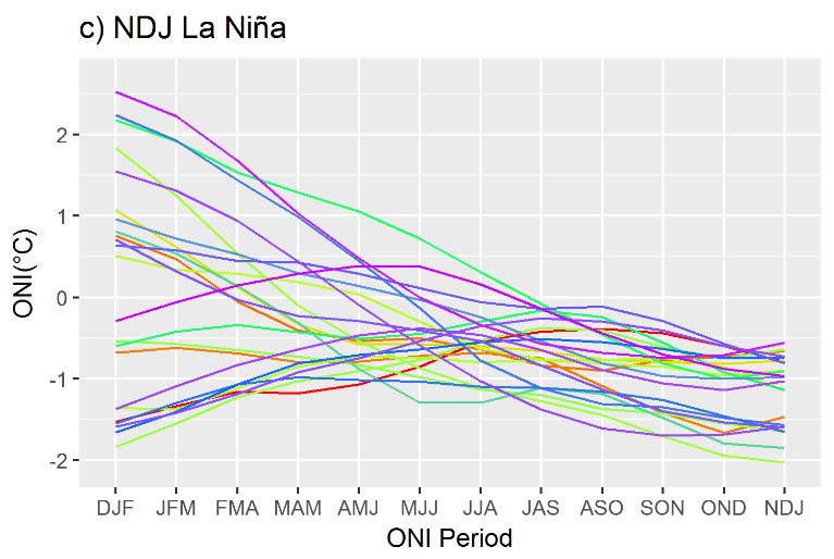
El Niño conditions might (and often do) only exist for a short period before heading quickly into a La Niña (Figure 1c). In other cases, El Niño can stick around all year (Figure 1a). Before the spring, accurate prediction of ENSO is limited due to a lull in forecasting skill—something climate scientists call the “spring predictability barrier.” This lull occurs for many reasons and remains a heavily researched topic; interactions between the ocean and atmosphere are weaker in the spring and a phenomenon known as the westerly wind bursts—thought to be important in the creation of El Niño events—occur in the spring.
Research regarding ENSO forecasting and the relationship between ENSO and crop yields has increased in recent years. Because of the potential importance of ENSO to crop risk assessment and management, AIR continually investigates how ENSO and other climatic drivers affect crop yield and applies that knowledge to further development of our crop (re)insurance products.
Learn more about how modeling can help you realistically capture your crop risk