The Way You Manage Flood Risk Is About to Change
Inland flooding in the United States causes more than USD 5 billion in economic loss every year. Today the insurance industry lacks the tools to accurately quantify the risk. That’s about to change.
Drawing on our extensive experience with modeling flood hazard, AIR is answering the call for advanced risk management tools with the introduction of the industry’s most detailed physically based, fully probabilistic inland flood model for the United States.
This game-changing model, scheduled for release in fall 2014, will enable companies to make more informed underwriting and pricing decisions, develop more effective portfolio management and risk financing strategies, and explore new opportunities for product innovation.
Expanding on Innovation
Modeling inland flood is complex. From rainfall generation to hydraulic flow, it is critical that a model capture all of the complexities that represent flood risk—and at high resolution.
AIR’s inland flood models in Germany and the UK have set a new standard for managing flood risk in Europe. And now AIR is applying our deep expertise in modeling this peril to undertake one of the most ambitious endeavors in the company’s history.
Setting the Standard in Engineering Research
Using the results of engineering analyses, published research, damage surveys conducted by AIR, and insurance loss data, AIR engineers have developed flood damage functions (mathematical relationships that translate flood depth into monetary losses) for residential and commercial exposures, large industrial facilities, and automobiles.

Fully Account for the Possible Failure of Flood Defenses
Information on flood defenses in the U.S. is critical for assessing flood risk and mitigating loss. The model incorporates extensive levee data from FEMA, the USGS, and the U.S. Army Corps of Engineers. Unlike FIRM maps, the AIR model considers the area behind levees to also be at risk from flooding. Without proper treatment of the possibility of flood defense failure, modeled losses can be off by an order of magnitude.
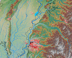
Left: Simulated levee breach on the Lower Mississippi River.
Providing New Opportunities for Insurance Industry
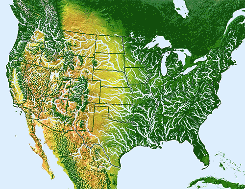
Realistically capturing flood risk on more than 1.4 million miles of river networks is a formidable challenge—one that AIR has met.
Armed with AIR’s new U.S. inland flood model, insurers will be able to make more informed underwriting and pricing decisions, and develop effective portfolio management, risk financing, and risk management strategies.
Right: Inundation depth is captured along more than 1.4 million miles of river network and over 335,000 catchments.